The rapid development of El Niño in 2026 is expected to significantly alter weather patterns across the globe. This evolution is not just a minor shift; it threatens to reshape climate dynamics worldwide.
Recent observations indicate that El Niño is developing faster and stronger than previously projected. Subsurface anomalies point toward a trajectory that could lead us into a Super El Niño status by the second half of 2026. This transition marks a significant change from the prolonged La Niña influence we’ve experienced over the past few years.
Key factors driving this development:
- A powerful oceanic Kelvin wave has intensified, effectively ending the multi-year La Niña period.
- Forecast models from ECMWF and UKMO now show a stronger El Niño signature in Summer 2026 pressure patterns than earlier updates suggested.
- The average-to-upper value of forecasts indicates a very high chance for a Super El Niño to develop.
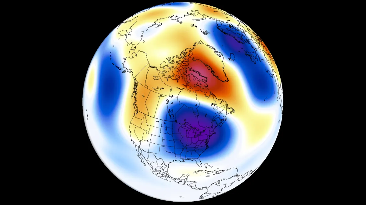
As we look ahead to Summer 2026, meteorologists predict distinct regional impacts. A low-pressure area is anticipated over eastern Canada and the northeastern United States. Meanwhile, above-normal temperatures are forecast for the northwestern United States and western Canada.
Rainfall patterns will also shift dramatically. More precipitation is expected across the western, central, and northeastern United States, including the Midwest and southeastern Canada. Conversely, less precipitation could affect the far southern United States and parts of southern and central Canada.
Yet, uncertainties linger. While models show these trends, exact outcomes remain elusive. How different regions will adapt to these changes—and how they might mitigate potential adverse effects—poses an intriguing challenge for scientists and policymakers alike.
Daniel Fairbrother is the Senior Football Correspondent at Latest News UK, covering the Premier League, the EFL and the England national side with over a decade of reporting experience. He spent eight years on the football desk of a Yorkshire daily before moving into national coverage. He holds a degree in Sports Journalism from the University of Sunderland and completed an NCTJ diploma. Based in Leeds, he watches non-league football and runs a five-a-side league. “The best football stories are won in the week, not on the whistle.”